Blizzard alert in California: when the storm arrives and most affected areas
Historic blizzard warnings have been issued across southern California. Where is the storm expected to hit and when will it arrive?
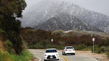

Communities all over southern California are under a historic blizzard warning as a major storm is expected to roll through the area, the first blizzard to hit the LA area since 1989. Granada Hills, a suburban neighborhood of Los Angeles, is already seeing snow, and the National Weather Service is warning residents to prepare because much more could be on the way.
Snow at O’Melvany, Granada Hills CA just now. @NWSLosAngeles pic.twitter.com/IuCnoFQsjK
— yourworstship (@katequackin) February 23, 2023
Where have warnings been issued?
Several severe weather warnings and advisories have been released by the National Weather Service across southern and central California.
National Weather Service San Diego
The National Weather Service (NWS) outpost in San Diego has issued a blizzard warning for the San Bernardino County Mountains that will remain in effect until at least Friday at 4 am PT. Snow actuation will begin at around 4000 feet, with the NWS estimating that between two and four inches will fall in the area. At 5000 feet, snowfall could reach between three and five feet. At higher altitudes, a blizzard could hamper visibility with fog and heavy snow limiting sight to a quarter of a mile.
National Weather Service Hanford
The National Weather Service office in Hanford oversees cities including Tuolumne Meadows, Wawona, Devils Postpile, Florence Lake, Lake Thomas Edison, Lake Wishon, Huntington Lake, Shaver Lake, Cedar Grove, Grant Grove, Hume Lake, Giant Forest, Lodgepole, and Johnsondale has already released a series of warnings.
- Blizzard: Snow is expected in this area at 8000 feet, and the agency projects that between 38 to 73 inches of snow could fall. At these altitudes, wind gusts could reach 60 mph, which, combined with the snowfall, could make travel “impossible” and may “impact the morning or evening commute” of residents in the area. In effect until 4 pm PT on Saturday.
- Blizzard: At lower elevations, particularly communities in Tehachapi, Grapevine, and around the Frazier Mountains, are under a Blizzard Warning until 8 pm PT on Friday. Snowfall could reach 37 inches, with wind gusts hitting up to 65 mph. A Winter Storm Warning will also remain in effect until 4 pm PT on Saturday, as heavy snow, aside from the risk of blizzard conditions, is expected in the area.
National Weather Service Los Angeles/Oxnard CA
A handful of warnings have also been issued by the NWS offices in Los Angeles and Oxnard as well.
A Winter Storm Warning, in effect until 4 am PT on Friday, and a Blizzard Warning from 4 am PT on Friday through 4 pm to 4 PM PST Saturday, have been issued for the Ventura County Mountains and Los Angeles County Mountains. At low elevations, “snow, strong winds and very cold wind chills” are expected. Blizzard conditions could materialize as well, with “winds gusting up to 80 mph, and near zero visibility.” Between 2000 and 4000 feet, six to twelve inches are expected to accumulate, and at higher elevations, as much as eight feet could fall.
Related stories


In the Santa Barbara County Interior Mountains, a Blizzard and Winter Storm Warning have been issued and will remain in effect until 4 pm PT on Saturday. Heavy snow, up to three feet at more than 3500 feet, is expected, and wind gusts could reach 65 mph. Officials warn that these conditions may make travel “impossible” and to watch out for damage caused by “strong winds.”
We are still on track for our DANGEROUS winter storm. Expect blizzard conditions in the mountains with FEET of snowfall. A few inches of rain are expected in lower elevations. Be weather ready! #CAwx #LArain #LAsnow #blizzard pic.twitter.com/HbUn08J2qQ
— NWS Los Angeles (@NWSLosAngeles) February 23, 2023
NWS advises drivers in affected areas to stay off the road
Many in southern California may not be used to these conditions, so the NWS is working to inform the public of the risks. “If you must travel, keep an extra flashlight, food, and water in your vehicle in case of an emergency,” said the agency, adding that “travel should be restricted to emergencies only.” If, for some reason, you are forced to pull over because of the storm, it is best to stay in your vehicle to avoid exposure to the blizzard conditions, which can be deadly.