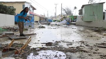
Hurricane alert: When could storm Beryl hit the US?
Hurricane Beryl, one of the first major storms of the season, is heading toward Jamaica. Could it make its way to the US? Let’s take a look at the forecast


The US National Weather Service (NWS) reports that Hurricane Beryl is expected to land in Jamaica on Wednesday, 3 July, bringing with it anywhere between 4 to 8 inches of rain. Flash flooding is a real threat, and residents are urged to take the necessary precautions as the storm approaches.
Hurricane #Beryl Advisory 16: Beryl Continues Moving Quickly West-Northwestward Across The Central Caribbean Sea. Expected to Bring Life-Threatening Winds and Storm Surge To Jamaica On Wednesday. https://t.co/tW4KeGe9uJ
— National Hurricane Center (@NHC_Atlantic) July 2, 2024
The Lesser Antilles, which are made up of the Leeland and Windward Island chains, are typically sheltered from hurricanes because of their southern position within the Caribbean. Hurricane Beryl not only makes history as the only storm to form in June and hit the area, but it is also the earliest Category 5 Hurricane recorded since these weather phenomena began to be tracked more than one hundred years ago. A warmer ocean makes for more powerful storms, and with the National Oceanic and Atmospheric Administration (NOAA) forecasting a more active hurricane season this year, Hurricane Beryl provides a possible glimpse into what might be coming.
A menacing view of Category 5 Hurricane #Beryl in the Caribbean Sea this morning 😬 pic.twitter.com/oOpQbanbAa
— Zoom Earth (@zoom_earth) July 2, 2024
Will Hurricane Beryl make landfall in the US?
The US territory of Puerto Rico is already feeling the effects of Hurricane Beryl. High winds and heavy rain are pummeling the island far from the hurricane’s epicenter, providing more evidence of its strength.
6:30 am Showers, thunderstorms squalls and windy conditions are happening now in #PuertoRico due to the track of #Beryl (with sustained winds 165 mph). Its eye is around 200 miles from the southwest coast and moving away in the Caribbean sea to the south of Hispaniola. This video… pic.twitter.com/LC20byna2P
— Ada Monzón (@adamonzon) July 2, 2024
Related stories
But what about the states around the Gulf of Mexico or those along the eastern seaboard? As of Tuesday morning on 2 July, the NWS has been unable to forecast the direction in which the storm will move after hitting Jamaica. The most up-to-date forecasts that project the path of the storm over the next five days show the southernmost point in Texas as the only US state or territory that could be impacted by the storm.
Here are the 5am EDT Tuesday Key Messages for Category 5 Hurricane #Beryl over the eastern Caribbean . New for this advisory is a Hurricane Watch for all of the Cayman Islands. More: https://t.co/tW4KeGe9uJ pic.twitter.com/hBSYS1BS4o
— National Hurricane Center (@NHC_Atlantic) July 2, 2024
Authorities in Mexico are not in the same position and are preparing for the storm to make landfall within the territory.
Complete your personal details to comment