Manuel Berrocoso, scientist: “Antarctica is showing us extraordinary geodynamic activity”
Antarctica’s hidden forces: Spanish scientist reveals to AS what decades of research are uncovering beneath the ice.

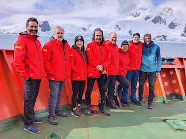
Manuel Berrocoso, a scientist at the University of Cádiz and one of Spain’s leading experts in Antarctic geodynamics, has just returned from another research campaign in the South Shetland Islands, the Bransfield Sea, and the Antarctic Peninsula. With more than 35 years of work on the frozen continent, he explains how geodynamic processes are changing, what new scientific stations are revealing, and why Spanish research is now a global reference point.
In this interview with AS, he details the latest findings from his work.
Are we witnessing an acceleration of processes that once unfolded over centuries? Have we reached a point of no return?
In the Antarctic region where we work – the South Shetland Islands, the Bransfield Sea, and the Antarctic Peninsula – the retreat of sea ice could introduce changes in geodynamic processes, especially in terms of lithospheric uplift. This would add to the post-glacial rebound already recorded on the Antarctic Peninsula through GNSS satellite observations.
However, the effects are not uniform. In the South Shetland Islands, subsidence occurs because the Phoenix microplate is subducting beneath the Antarctic Plate. That means the deformation caused by reduced ice pressure will likely not be very significant overall. Still, it could appear in localized areas of the archipelago linked to active volcanism, such as Deception Island and Penguin Island.
Deception Island is one of the most studied volcanoes in the world. Tell us more.
Since the beginning of Spain’s Antarctic campaigns more than 35 years ago, scientists have monitored the volcanotectonic geodynamic activity of Deception Island, and continuously since the 2000-2001 campaign. Volcanically, the island operates through a cycle that includes an opening and uplift phase, a transition phase, and a compression and subsidence phase. These phases allow us to determine the island’s volcanic activity level using the parameter of surface deformation.
Could melting ice alter that activity?
A higher level of ice melt could mean an additional recharge of the hydrothermal system. However, the melting occurring in West Antarctica would not introduce significant changes in the volcanotectonic geodynamic processes taking place in the South Shetland Islands.
Some of the most interesting signals are coming not from the ice but from ocean measurements. Can you explain?
Geodetic series are not directly affected by meteorological conditions. We have not detected deformation anomalies linked to those factors. But we have detected signals associated with major volcanic events. In underwater temperature records, we have identified geophysical phenomena connected to distant volcanic activity, such as the eruption of the Hunga Tonga volcano in January 2022, as well as volcano-tectonic processes like those occurring at the Orca submarine volcano.
Before that event, we observed a very significant increase in deformation at Deception volcano, even without seismic activity. The deformation – about 8 inches per year (20 cm) – clearly signaled a pre-eruptive process, but it later migrated to the Orca submarine volcano roughly 80 miles (130 km) away. Between August 2020 and February 2021, around 85,000 earthquakes were recorded. This huge release of energy was detected by tide gauges installed on Deception and Livingston islands. From 2021 to 2025, temperatures did not reach the lower limit of −2°C (28.4°F) even during the winter phase. These observations highlight the intense geodynamic activity of the Bransfield spreading rift and the direct interconnections between different zones within it.
What technological leap has transformed Antarctic science?
There has been enormous progress in experimental processes in Earth sciences. We moved from data acquisition systems with limited storage and high power consumption to modern low-consumption GNSS equipment with large storage capacity. This advance has dramatically improved the quality of observations and allows continuous time series capable of tracking geodynamic activity – both tectonic and volcanic – even in real time.
Among the achievements are identifying the geodynamic mechanism of Deception volcano, establishing real-time monitoring and activity forecasting, building the geodynamic model for the South Shetland Islands and the Bransfield Sea, and understanding submarine temperature behavior and sea-level evolution.
From Antarctica to the Canary Islands, Cádiz, or Mexico, what impact has Spanish Antarctic science had?
Since Spain’s presence in Antarctica began, techniques and methodologies developed there have been transferred to other tectonic and volcanic regions. Examples include the Andalusian Positioning Network (2005-2016), GNSS networks in Tenerife, the monitoring system designed for the El Hierro eruption (2011-2014), and a GNSS network studying tectonic geodynamics in the Gulf of Cádiz. Similar systems have also been used at Mexico’s Popocatépetl volcano, Nicaragua’s Concepción volcano, and Cerro Blanco in Argentina.
What projects are you carrying out during this campaign?
In this campaign we are working on two projects. The first is GEO2OCEAN, which maintains the historical geodetic, geothermal, and oceanographic series on Deception and Livingston islands. These guarantee continuity of GNSS observations since 2000, temperature-anomaly records since 2012, and oceanographic measurements since 2011. These time series are unique, and the GNSS record is among the longest in Antarctica.
The second is ATMESHET: Temporal analysis and spatial modeling of active tectonic and volcanic processes using GNSS and seismogeodetic time series in the South Shetland Islands and the Antarctic Peninsula. During this campaign, four multiparametric stations were installed across the region, each equipped with GNSS systems, seismic stations, accelerometers, and tide gauges.
Additional GNSS equipment has been installed across several islands and monitoring sites, expanding the geodetic, geophysical, and oceanographic network already supported by the Spanish Antarctic bases Juan Carlos I and Gabriel de Castilla.
This instrumentation will make it possible to obtain annual geodetic, geophysical, and oceanographic time series. Studying them will mark a milestone in understanding the geodynamic processes occurring in the region. The techniques developed there can then be applied to closer areas such as southern Iberia, North Africa, the Canary Islands, or even highly active volcanic regions in Latin America such as the Mexican Volcanic Belt. The project involves researchers from multiple institutions including the University of Cádiz, the Hydrographic Institute of the Navy, the Royal Observatory of the Navy, the University of Granada, the University of Modena and Reggio Emilia in Italy, the University of Algarve in Portugal, and Mexico’s CENAPRED.
Is Spain’s Antarctic logistics are now among the best in the world?
Logistics have developed to such an extent that today we rank among the top internationally in the quality of land infrastructure, including the Juan Carlos I and Gabriel de Castilla bases. Spain’s scientific fleet – with three research vessels, Hespérides, Sarmiento de Gamboa, and Odón de Buen – allows increasingly ambitious projects.
But the biggest revolution has been communications. Being able to connect with family at any time, transmit results in real time, and improve navigation safety has transformed Antarctic research.
You have dedicated your entire career to Antarctica?
I have devoted my entire professional life to research in Antarctica. Now I can see how much the scientific process has evolved in nearly every respect. I would also like to recognize the enormous effort this work demands from our families, because they are the ones most aware of where we are and the risks we face. Despite all the advances, we are still very far away from them.
Related stories
Get closer to the game! Whether you like your soccer of the European variety or that on this side of the pond, our AS USA app has it all. Dive into live coverage, expert insights, breaking news, exclusive videos, and more. Plus, stay updated on NFL, NBA and all other big sports stories as well as the latest in current affairs and entertainment. Download now for all-access coverage, right at your fingertips – anytime, anywhere.
And there’s more: check out our TikTok and Instagram reels for bite-sized visual takes on all the biggest soccer news and insights.
Complete your personal details to comment