Storm Philippe path and predictions: How can it affect New York and New England? When will it arrive?
Storm Philippe is still on track to bring high rain and winds to the northeast. When will the storm make landfall? Storm Philippe path and predictions...


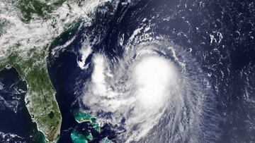
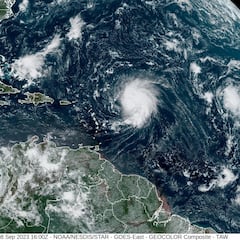
A storm is heading towards the Northeast, post-tropical cyclone Philippe, and is expected to make landfall at 8:00 AM Sunday in Maine. Philipe was downgraded from a tropical storm on Friday.
Post-Tropical Cyclone #Philippe Advisory 53: Philippe Becomes Post-Tropical But Still Poses a Risk of Flash Flooding Across New England This Weekend. This is the Last Nhc Advisory. https://t.co/tW4KeGdBFb
— National Hurricane Center (@NHC_Atlantic) October 6, 2023
What is a post-tropical cyclone?
The National Weather Service (NWS) describes a storm of this nature as “a cyclone that no longer possesses sufficient tropical characteristics to be considered a tropical cyclone.” However, these storms “can continue to carry heavy rains and high winds,” and caution should still be taken.
Where will the storm hit?
The storm is expected to continue moving parallel to the eastern seaboard until it makes landfall in Maine, bringing rain, high winds, and the chance of flooding to areas across New England and the northeast. Residents in these states should be aware of and follow guidance issued by the NWS to stay safe as the storm passes through.
The areas that are expected to see the highest levels of rain are northern New York, northern Maine, and Much of Vermont, where the NWS expects around four inches to fall. The surrounding states could see between one and three inches.
This may interest you: What was the strongest hurricane ever recorded? Where and when was it?
Areas that could experience flash flooding
Related stories
In most of Maine, parts of Vermont, New Hampshire, New York, Connecticut, and Massachusetts, there is a 15 percent chance of flash flooding.
11 am AST Friday, Oct. 6 Key Messages for Post-Tropical Cyclone #Philippe. Future information on the post-tropical cyclone can be found in products from @NWSWPC, @NWSOPC, and local @NWS offices.
— National Hurricane Center (@NHC_Atlantic) October 6, 2023
https://t.co/MQ55KaJDJv pic.twitter.com/pKmPKP3nsC
In areas covering the surrounding states of Pennsylvania and New Jersey, that risk falls to five percent.

