Track wildfire smoke in real time across North America
Interactive map of North America showing where the fires are burning and where the smoke is expected to move in the coming days, along with PM2.5 levels.


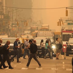
Wildfires in Canada have sent smoke pouring across parts of the U.S. in the past few days, with air quality severely affected. New York has been blanketed by an ominous orange haze for two days.
If you want to track both the location of the wildfires and where the smoke is expected to be your best bet may be FireSmoke Canada, which offers information about wildland fire, weather and smoke. They offer an interactive map showing where the smoke will be, and in particular where the most dangerous tiny particles, called PM2.5 particles, will be.
The dangers of small particles
PM2.5 particles are Particulate Matter (ambient airborne particles) which measure up to 2.5 micrometers in size. They are extremely small particles, roughly 3% of the diameter of a human hair, and are not visible to the naked human eye.
Related stories

What to do when air quality is poor

What is a code red air quality alert?
PM2.5 particles are of concern because they are small enough to be inhaled into the respiratory system and can even penetrate into the alveoli (tiny air sacs in the lungs where oxygen and carbon dioxide exchange occurs). They can carry a range of toxic compounds, such as heavy metals and polycyclic aromatic hydrocarbons, which can have various harmful effects on the body.
Exposure to PM2.5 can have both short and long-term health impacts. The short-term effects can include irritation in the eyes, nose, and throat, coughing, sneezing, runny nose, and shortness of breath. Long-term exposure can lead to more serious health problems such as respiratory and heart diseases, lung cancer, and can even contribute to premature death.