What are the spaghetti models that are checked during hurricane season and how to read them?
Forecasters are monitoring a weather system that is becoming better organized and likely to develop into Hurricane Helene before hitting the United States.


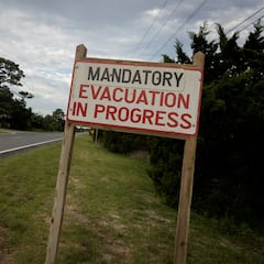
North America is bracing for two powerful storms: Hurricane John has already made landfall in southern Mexico, while Hurricane Helene is expected to develop within the next few days and slam into parts of Florida, where a state of emergency has already been declared.
Meteorologists are still trying to pinpoint where Helene will make landfall, and determine when it will reach hurricane strength. They say it is still too early to make accurate predictions about the “when”, “where”, and “how strong” of this storm.
Although weather phenomena are unpredictable, scientists use different tools, including spaghetti models, to forecast a storm’s behavior.
READ ALSO: Potential Hurricane Helene approaches US: live updates
Latest Tuesday AM spaghetti models on https://t.co/3cvwpvVJ22. No big changes with solid agreement still right now. Major Hurricane expected by Thursday. https://t.co/Hk3pbO7x8H pic.twitter.com/k9QVqHJFgo
— Mike's Weather Page (@tropicalupdate) September 24, 2024
READ ALSO: Two hurricanes to batter North America
What are the spaghetti models that are checked during hurricane season?
The National Hurricane Center uses spaghetti models, a type of visualization used in meteorology, to track and predict the paths of tropical cyclones such as hurricanes and tropical storms, as well as areas that could be affected.
They share these models to the public to communicate the uncertainty in storm forecasts, and to show them that predictions can change.
These models consist of multiple forecast tracks generated by different weather prediction models, all plotted on the same map. The resulting image resembles strands of spaghetti; thus, the name.
READ ALSO: How hurricanes get named
There are different kinds of spaghetti models: statistical, which are based on data such as storm behavior, location, and date; dynamical, which are based on complex mathematical equations that simulate the physics of the atmosphere; and ensemble or consensus models which combine forecasts of several models.
The NHC uses the following global and regional dynamical models to predict the track and intensity of the storms, as well as wind radius.
READ ALSO: Defining a hurricane
| Global/Regional Model Name | Description |
|---|---|
| Navy Global Environmental Model | Used by the U.S. Navy, this model provides global weather forecasts, including tropical systems. |
| Global Forecast System (FV3-GFS) | Run by the National Oceanic and Atmospheric Administration (NOAA), it provides forecasts up to 16 days into the future. |
| European Centre for Medium-Range Weather Forecasts | Known for its accuracy, this model provides forecasts up to 10 days ahead. |
| U.K. Met Office Global Model | The UK’s global model, which also contributes to the ensemble of global forecasts. |
| Canadian Deterministic Prediction System | The Canadian global model provides forecasts and is used alongside GFS and ECMWF for comparison. |
| Hurricane Weather Research and Forecast system | Specifically designed for predicting hurricanes, providing detailed forecasts. |
| NRL COAMPS-TC w/ GFS initial and boundary conditions | A high-resolution, mesoscale model specifically designed to predict tropical cyclone behavior, including track, intensity, and structure. |
| Hurricane Multi-scale Ocean-coupled Non-hydrostatic model | An advanced weather prediction model specifically designed for forecasting tropical cyclones. |
For more details on these models, check out the NOAA-NHC website.
How to read spaghetti models
These models allow meteorologists and the public to compare different models and see which ones are in agreement or disagreement.
When multiple model tracks are closely clustered, this shows a consensus among the models, resulting in higher confidence in the forecast path.
Related stories

When the tracks diverge widely, it indicates greater uncertainty and the need for continued monitoring of the storm’s evolution.
Meteorologists also watch out for trends. Observing how the consensus of the models shifts over time can provide insight into changes in the forecast and potential impacts. Combined multiple models provide a more comprehensive view that aids in assessing the risk to different areas and in making informed decisions about preparedness and evacuation.
Complete your personal details to comment