Winter Weather Alert: Which states will see snow storms today, Thursday, January 4?
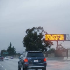
Winter weather will be causing disruption in the freezing northern state of Alaska while warnings have been issued further south in California and Nevada.

Cold temperatures and snow are creating dangerous conditions around the country. The National Weather Service (NWS) has issued dozens of alerts. If you live in an affected area, it is advised that you take the proper precautions to stay safe. We have compiled all of the current winter alerts active for Wednesday 27 December, and for the full details, check out the NWS website.
What is a Winter Weather Advisory?
The NWS issues a Winter Weather Advisory “for any amount of freezing rain, or when 2 to 4 inches of snow (alone or in combination with sleet and freezing rain), is expected to cause a significant inconvenience, but not serious enough to warrant a warning.” For the details, please review the information uploaded to the NWS website, which compiles and updates these alerts.
What is a Winter Storm Warning?
The more severe alert issued by the NWS is a Winter Storm Warning, which includes “heavy snow of at least six inches in 12 hours, or at least eight inches in 24 hours, is expected. It can also be issued if sleet accumulation will be at least half an inch.”
What is a Freezing Fog Advisory?
The NWS issues a Freezing Fog Advisory when visibility is below one mile in freezing fog. Low visibility can make driving conditions hazardous. Freezing fog will also lead to icy spots on roadways, especially on elevated surfaces such as overpasses and bridges.
What is an Ice Storm Warning? A Blizzard Warning?
Related stories

The NWS also issues other severe weather alerts: one is called an Ice Storm Warning, where ice accumulation of at least one-fourth of an inch is expected, while a Blizzard Warning is given when blizzard conditions are expected for at least three hours.
Alaska
Winter Weather Advisory
- Bering Strait Coast: UNTIL 6 PM AKST THURSDAY
- Central Brooks Range: UNTIL 3 PM AKST FRIDAY
- Municipality of Skagway: UNTIL NOON AKST THURSDAY
- Southern Seward Peninsula Coast: UNTIL 3 PM AKST THURSDAY
- St Lawrence Island: UNTIL 2 PM AKST THURSDAY
- White Mountains and High Terrain South of the Yukon River: UNTIL 3 PM AKST THIS AFTERNOON
- Yukon Delta Coast: UNTIL 6 AM AKST THURSDAY
Winter Storm Warning
- Upper Koyukuk Valley-Dalton Highway Summits: UNTIL 3 PM AKST THIS AFTERNOON
Arizona
Winter Weather Warning
- Chuska Mountains and Defiance Plateau-Little Colorado River Valley in Apache County-White Mountains: UNTIL 6 PM MST THIS EVENING ABOVE 5000 FEET
- Northeast Plateaus and Mesas Hwy 264 Northward-Chuska Mountains and Defiance Plateau-
Little Colorado River Valley in Apache County-Eastern Mogollon Rim-White Mountains-Northern Gila County-Black Mesa Area-Northeast Plateaus and Mesas South of Hwy 264: UNTIL 8 AM MST THIS MORNING ABOVE 5000 FEET - White Mountains of Graham and Greenlee Counties: UNTIL NOON MST TODAY
Colorado
Winter Weather Advisory
- Animas River Basin-San Juan River Basin: UNTIL 11 PM MST THIS EVENING
- Eastern Las Animas County-Springfield Vicinity/Baca County: FROM 11 AM THURSDAY TO 5 AM MST FRIDAY
- Eastern San Juan Mountains Above 10000 Feet: UNTIL 11 PM MST THURSDAY
- Four Corners/Upper Dolores River: UNTIL 5 PM MST THIS AFTERNOON
- Southern Sangre de Cristo Mountains Between 7500 and 11000 Feet-Southern Sangre de Cristo Mountains Above 11000 Feet: FROM 8 AM THURSDAY TO 5 AM MST FRIDAY
- Southwest San Juan Mountains: UNTIL 11 PM MST THIS EVENING
- Wet Mountains between 6300 and 10000 Feet-Wet Mountains Above 10000 Feet-Walsenburg Vicinity/Upper Huerfano River Basin Below 7500 Feet-Trinidad Vicinity/Western Las Animas County Below 7500 Feet: FROM 11 AM THURSDAY TO 5 AM MST FRIDAY
Kansas
Winter Weather Advisory
- Barton-Rice-McPherson-Marion-Chase-Reno-Harvey-Butler-Greenwood-Woodson-Kingman-Sedgwick-Harper-Sumner-Cowley-Elk-Wilson-Chautauqua-Montgomery: FROM 9 PM THIS EVENING TO 6 PM CST FRIDAY
- Cheyenne-Rawlins-Decatur-Norton-Sherman-Thomas-Sheridan-Graham-Wallace-Logan-Gove-Greeley-Wichita-Dundy-Hitchcock-Red Willow: FROM 11 AM MST /NOON CST/ THURSDAY TO 11 AM MST /NOON CST/ FRIDAY
- Scott-Hamilton-Kearny-Finney-Stanton-Grant-Haskell-Morton-Stevens-Seward: FROM 3 PM CST /2 PM MST/ THIS AFTERNOON TO 9 AM CST /8 AM MST/ FRIDAY
- Trego-Ellis-Lane-Ness-Rush-Hodgeman-Pawnee-Stafford-Gray-Ford-Edwards-Kiowa-Pratt-Meade-Clark-Comanche-Barber: FROM 8 PM THIS EVENING TO NOON CST FRIDAY
Minnesota
Winter Weather Advisory
- North Itasca-South Itasca-Northern Aitkin: FROM NOON FRIDAY TO 6 PM CST SATURDAY
- North St. Louis-Northern Cook and Lake-Central St. Louis-Carlton and South St. Louis: FROM NOON FRIDAY TO 6 AM CST SUNDAY
- Southern Lake-Southern Cook: NOON FRIDAY TO 6 AM CST SUNDAY
Nebraska
Winter Weather Advisory
- Keith-Perkins-Lincoln-Chase-Hayes-Frontier: FROM 9 AM CST /8 AM MST/THIS MORNING TO NOON CST /11 AMMST/ FRIDAY
- Phillips-Rooks-Furnas-Harlan: FROM 9 AM THIS MORNING TO NOON CST FRIDAY
- Smith-Osborne-Dawson-Buffalo-Gosper-Phelps-Kearney-Franklin: FROM 9 AM THIS MORNING TO NOON CST FRIDAY
Nevada
Winter Weather Advisory
- Eastern Sierra Slopes-White Mountains of Inyo County: FROM 10 PM THIS EVENING TO 1 AM PST THURSDAY ABOVE 7000 FEET
- Greater Lake Tahoe Area-Greater Lake Tahoe Area: FROM 7 PM THIS EVENING TO 1AM PST THURSDAY FOR THE TAHOE BASIN ABOVE 7000 FEET
- Lincoln County: FROM 8 AM WEDNESDAY TO 4 AM PST THURSDAY ABOVE 6000 FEET
- Mono County: FROM 7 PM THIS EVENING TO 1AM PST THURSDAY FOR MONO COUNTY ABOVE 7000 FEET
- Northern Elko County: UNTIL 4 AM PST THURSDAY
- Northwest Plateau: FROM 2 PM WEDNESDAY TO 5 AM MST THURSDAY ABOVE 5000 FEET
- Ruby Mountains and East Humboldt Range-White Pine County-Northern Lander County and Northern Eureka County-Southern Lander County and Southern Eureka County-Southwest Elko County-Northeastern Nye County: UNTIL 4 AM PST THURSDAY ABOVE 6500 FEET
- Sheep Range-Spring Mountains-Red Rock Canyon: UNTIL 4 AM PST THURSDAY ABOVE 6000 FEET
New Mexico
Winter Weather Advisory
- Central Grant County/Silver City Area-Southern Gila Region Highlands/Black Range: UNTIL 5 PM MST THURSDAY
- Northwest Plateau-Chuska Mountains-Far Northwest Highlands-Northwest Highlands-West Central Highlands-Southwest Mountains: UNTIL 11 PM MST THIS EVENING
- Sacramento Mountains Above 7500 Feet: FROM 5 AM TO 5 PM MST THURSDAY
- Upper Rio Grande Valley-Espanola Valley-Santa Fe Metro Area-Central Highlands-South Central Mountains-Eastern San Miguel County: UNTIL 6 AM MST FRIDAY
Winter Storm Warning
- West Central Plateau-West Central Mountains: UNTIL 11 PM MST THIS EVENING
Oklahoma
Winter Weather Warning
- Harper-Woods-Alfalfa-Ellis-Woodward: FROM 8 PM THURSDAY TO NOON CST FRIDAY
Texas
Winter Weather Advisory
- Cimarron-Texas-Beaver-Dallam-Sherman-Hansford-Ochiltree-Hartley-Moore-Hutchinson-Oldham-Potter-Deaf Smith-Randall-Palo Duro Canyon: FROM NOON TODAY TO 10AM CST FRIDAY
- Lipscomb-Roberts-Carson-Gray-Armstrong: FROM NOON TODAY TO 10 AM CST FRIDAY
- Parmer-Castro-Swisher: FROM NOON THURSDAY TO 6 AM CST FRIDAY
Utah
Winter Weather Advisory
- Southern Mountains: UNTIL 11 PM MST THURSDAY
It’s important to keep yourself updated with the latest weather alerts. To get the full details, you can visit the NWS website. In most cases, these warnings will advise you to stay off the roads or take necessary precautions. For instance, make sure to give yourself extra time to reach your destination as the roads might be slippery and require you to slow down at certain points. When you’re not on the road, it’s also important to be cautious while walking on walkways, sidewalks, and paths as they can become icy and increase the risk of injuries.