


WEATHER
Winter Weather Alert: Which states will still see snow storms on Tuesday?
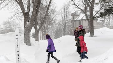
Winter weather is bringing cold temperatures and snow to areas across the US. Which states are under a Winter Weather Alert on Tuesday 28 November?

The National Weather Service (NWS) has issued severe weather alerts due to the current cold weather in the United States. It is crucial to check if you are in one of the affected areas and take necessary precautions to stay warm and safe.
Winter Weather Advisory
The following areas are under Winter Weather Advisory, which the NWS issues “for any amount of freezing rain, or when 2 to 4 inches of snow (alone or in combination with sleet and freezing rain), is expected to cause a significant inconvenience, but not serious enough to warrant a warning.” For the details, please review the information uploaded to the NWS website, which compiles and updates these alerts.
Michigan
- Southeast Chippewa, Western Mackinac and Eastern Mackinac Counties | Active through 7 AM EST on Tuesday
- Western Chippewa and Central Chippewa Counties | Active through 1 PM EST on Tuesday
- Portions of Northern Lower Michigan | Active until 11 AM EST on Tuesday
- Antrim, Otsego, Kalkaska, Crawford and Charlevoix Counties | Active until 1 PM EST
- Portions of south central, southwest and west central Michigan | Active through 11 AM EST on åTuesday
- Southern Schoolcraft County | Active until 7 AM EST on Tuesday
Minnesota
- Iron County | Active through 6 AM CST on Tuesday Morning
New York
- Southern Herkimer County | Active from 7 AM EST on Tuesday through 7 AM EST Wednesday
- Allegany County | Active through 7 AM EST on Wednesday
- Wayne County | Active from 10 AM EST on Tuesday through 7 AM EST on Wednesday
- Southern Oneida County | Active from 10 AM EST on Tuesday through 7 AM EST on Wednesday
- Southern Cayuga County | Active from 10 AM EST on Tuesday through 1 AM EST on Wednesday
Ohio
- Lorain, Summit, Portage and Trumbull Counties | Active through 7 PM EST on Tuesday
Pennsylvania
- McKean County | Active through 1 AM EST on Wednesday
- Forest, Mercer, and Venango Counties | Active until 7 PM EST on Tuesday
Source: National Weather Service
Winter Storm Warning
The more severe alert issued by the NWS is a Winter Storm Warning, which includes “heavy snow of at least 6 inches in 12 hours, or at least 8 inches in 24 hours, is expected. It can also be issued if sleet accumulation will be at least half an inch.” Michigan remains the only state under a Winter Storm Warning through 7 AM on Tuesday morning.
What is the NWS advising?
The cities impacted by the advisory are Grand Marais, Munising, Newberry, and Seney, and the NWS warns that this area is likely to see “heavy lake effect snow and patchy blowing snow.” Overall, anywhere between four to seven inches of snow could accumulate, with some areas seeing as many as ten inches. High winds will create hazardous conditions, particularly for those who hit the road. “Travel could be very difficult,” and these “conditions could impact the morning or evening commute,” reports the NWS.
It’s crucial to keep in mind that driving in poor visibility and hazardous conditions can impact your morning and evening commutes. The National Weather Service recommends that drivers carry a flashlight, food, and water in their car in case they are unable to reach their destination due to these conditions.