NASA cameras discover hidden city under arctic ice
Hidden beneath Greenland’s ice, NASA has stumbled upon a relic from the Cold War era.

NASA have accidentally rediscovered a Cold War-Era Base in Greenland. This rediscovery, rather than a new find, brings to light Camp Century, a U.S. military base abandoned in 1967. “At first, we didn’t know what it was,” explained the scientists.
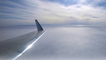
The discovery was made during an aerial survey of the region. In April, scientist Chad Greene captured images that have only now been released. The find occurred during a flight monitoring a radar instrument probing the ice sheet.
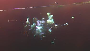
“We were looking for the ice bed, and there was Camp Century. At first, we didn’t know what it was,” said Alex Gardner, a cryospheric scientist at NASA’s Jet Propulsion Laboratory (JPL). It was Greene who captured the moment, taking a photo from the plane window, flying about 100 miles east of the U.S. Space Force’s Pituffik Space Base. Amid the vast ice sheet, something buried was revealed.

The Story of Camp Century
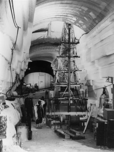
Known as “the city under the ice,” Camp Century is a true Cold War relic. Built by the U.S. Army Corps of Engineers in 1959, it involved cutting a network of tunnels near the surface of the ice sheet. Its operation was short-lived, abandoned in 1967 as snow began to entomb it. Today, it lies about 100 feet below the surface.
The radar used for its detection measures distance by sending out radio waves and timing their reflection back to the sensor. This allows experts to map the ice surface and its internal layers. Previous flights over Camp Century had detected signs of the base beneath the ice. However, the flights in April incorporated a new tool, the UAVSAR (Uninhabited Aerial Vehicle Synthetic Aperture Radar), which helped create more detailed maps. “In the new data, the individual structures of the secret city are visible in a way never seen before,” Greene explained.

Using maps obtained with conventional radar, scientists estimated the depth of Camp Century. The goal now is to determine when melting ice might once again expose this forgotten base.
But the discovery has broader implications. The team aimed to “calibrate, validate, and understand the capabilities and limitations of UAVSAR for mapping the internal layers of the ice sheet.” They hope these instruments will help measure ice thickness in similar environments in Antarctica and refine estimates of future sea level rise.
Related stories
Original article written by Raúl Izquierdo, translated with the assistance of AI and edited by Joe Brennan.
Get your game on! Whether you’re into NFL touchdowns, NBA buzzer-beaters, world-class soccer goals, or MLB home runs, our app has it all. Dive into live coverage, expert insights, breaking news, exclusive videos, and more – plus, stay updated on the latest in current affairs and entertainment. Download now for all-access coverage, right at your fingertips – anytime, anywhere.


Complete your personal details to comment