Snow advisory in California for Sept. 16: Which areas could see snow in late summer?
Parts of California could see a second round of snow Sunday night through Monday as a low pressure system moves over the West Coast.

A blast of cold air moving over the West Coast could bring a second round of snow to parts of California. Just a few weeks ago, the Golden State got its August snowfall in over two decades. However, temperatures returned to normal almost 24 hours later.
Now the National Weather Service has posted a Winter Weather Advisory for Sunday night through Monday evening. The cooler air will aid firefighters as they battle three wildfires burning in southern part of the state.
Here are the latest probabilities of 0.05 inches or more of rain. There is a 10 to 45 percent chance on Monday as part of the major cooldown with the trough moving through. #cawx pic.twitter.com/8SENHnSaKn
— NWS Hanford (@NWSHanford) September 15, 2024
Snow advisory in California for Sept. 16: Which areas could see snow in late summer?
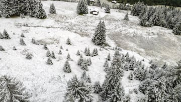
The National Weather Service in Hanford is cautioning those traveling in the vicinity of Yosemite National Park to Rodgers Ridge-Kings Canyon National Park to plan for slippery road conditions. This includes areas outside the valley and the Upper San Joaquin River.
There is a 40% chance that Tuolumne Meadows could see up to 2 inches of snow and temperatures will fall below freezing. Likewise, Tioga Pass has a 40% chance of receiving 3 inches of snow.
The Winter Weather Advisory runs from 11pm Sunday through 5 pm PDT Monday. Areas above 8,000 feet could see total snow accumulations of as much as 4 inches.
Related stories


Other cities included in the advisory are Cedar Grove, Devils Postpile, Florence Lake, Huntington Lake, Lake Thomas Edison, Lake Wishon, Shaver Lake and Wawona.
It’s recommended that you “slow down and use caution while traveling.” You can get the latest road conditions by calling 5-1-1.
Complete your personal details to comment