When will Hurricane Helena hit Florida? What counties will be most affected?
Hurricane Helene intensifies as it passes over the Gulf of Mexico, heading straight for Florida. What counties will be most affected?

Hurricane Helene is barreling towards Florida and could make landfall as a Category 3 storm later this afternoon into Friday. Storm surge is expected to rise as high as twenty feet in some areas, and officials have issued evacuation orders for those where the tide could rise to life-threatening levels.
Storm surge projections
- Carrabelle, FL to Suwannee River, FL: 15-20 ft
- Apalachicola, FL to Carrabelle, FL: 10-15 ft
- Suwannee River, FL to Chassahowitzka, FL: 10-15 ft
- Chassahowitzka, FL to Anclote River, FL: 8-12 ft
- Indian Pass, FL to Apalachicola, FL: 6-10 ft
- Anclote River, FL to Middle of Longboat Key, FL: 5-8 ft
- Tampa Bay: 5-8 ft
- Middle of Longboat Key, FL to Englewood, FL: 4-7 ft
- East of Mexico Beach, FL to Indian Pass, F: 3-5 ft
- Englewood, FL to Flamingo, FL: 3-5 ft
- Charlotte Harbor: 3-5 ft
Source: National Weather Service
Florida Gov. Ron DeSantis declares state of emergency
Earlier this week, spaghetti models showed Florida as one of the likely sites of Helene’s landfall, sending the state into emergency preparation mode. Currently, 61 of the state’s 67 counties are under a state of emergency declaration, allowing officials to send resources more quickly to areas that are likely to be impacted by the storm.
Florida is preparing for widespread impacts from Hurricane Helene. Sixty-one of Florida’s 67 counties are currently under a state of emergency.
— Ron DeSantis (@GovRonDeSantis) September 25, 2024
Do not get wedded to the “cone,” as hazards such as tornados, flooding, and storm surge can create dangerous conditions far beyond… pic.twitter.com/q568YSg2Nu
Counties expected to be hit by Hurricane Helene
The state has updated all of the severe weather alerts currently active as Helene approaches:
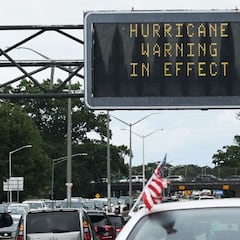
- Hurricane Warning: western Alachua, coastal Citrus, Columbia, Dixie, Franklin, Gadsden, Gilchrist, Gulf, Hamilton, coastal Hernando, Jefferson, Lafayette, Leon, Levy, Liberty, Madison, western Marion, coastal Pasco, Suwannee, Taylor and Wakulla counties
- Hurricane Watch: inland Citrus, inland Hernando, coastal Hillsborough, coastal Manatee, inland Pasco, Pinellas, coastal Sarasota
- Tropical Storm Warning: central and eastern Alachua, Baker, Bay, Bradford, Brevard, Broward, Calhoun, Charlotte, inland Citrus, Clay, Collier, DeSoto, Duval, Flagler, Glades, Hardee, Hendry, Highlands, inland Hernando, Hillsborough, Holmes, Indian River, Jackson, Lake, Lee, Miami-Dade, Monroe (including Florida Keys and Dry Tortugas), Manatee, central and eastern Marion, Martin, Nassau, Okeechobee, Orange, Osceola, Palm Beach, inland Pasco, Pinellas, Polk, Putnam, Sarasota, Seminole, St. Johns, St. Lucie, Sumter, Union, Volusia, Walton, Washington
- Storm Surge Warning: along the entire Florida Big Bend and West Coast through Southwest Florida Storm
- Surge Watch: Coastal Bay and Gulf counties along Mexico Beach to Indian Pass
Related stories
The National Weather Service (NWS) distinguishes between a Hurricane Warning and a Hurricane Watch to ensure those under the former understand that there is a greater risk. A Warning is issued when “hurricane conditions are expected somewhere within the warning area” and “typically” come around “36 hours before the anticipated first occurrence of tropical-storm-force winds.” For those under these warnings, any preparations to prepare for the storm should be completed in the coming hours.
On the other hand, the NWS issues a hurricane watch when “hurricane conditions are possible within the watch area.” These alerts are often issued over a larger region as officials become aware that a storm will materialize, and they are typically issued two days before the storm is expected to make landfall.


Complete your personal details to comment