How has the United States expanded its territory by a million square kilometers?
The United States has laid claim to coastal areas the size of Argentina, expanding its territory by one million square kilometers.
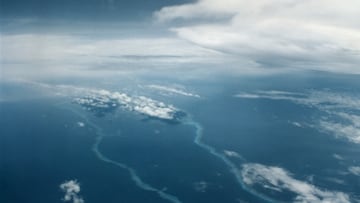

The United States is the fourth largest country in the world and has just announced that it is adding 1 million square kilometers to its territory. Where is this new land located? The Ocean, specifically areas of the Arctic, Pacific, and Atlantic.
A claim to the sea is made
The US federal government claims that an area equivalent to the size of Argentina belongs to the country. The additional area in the Arctic, which is intended to be used for scientific and commercial uses, is of great strategic importance to the country and all others that can make claims in the earth’s most northern region. As climate change creates commercial opportunities, countries are racing to make claims in the Arctic region. The melting of sea ice opens new waterways for countries to transport goods. Rising sea levels may destroy the lives of millions around the world, but the new trade routes highlight how businesses will be able to take advantage of the degradation.
How viable is Arctic shipping? https://t.co/9Jr8ptP5c8
— USARC (@US_ARC) January 18, 2024
The question of overlapping claims
Related stories
1982 United Nations Convention on the Law of the Sea is the treaty that allows parties to make claims to the continental shelf that borders their coastal areas. The treaty allows 200 nautical miles off the country’s coast to be claimed as territory of the member state.
The continental shelf of a coastal State comprises the seabed and subsoil of the submarine areas that extend beyond its territorial sea throughout the natural prolongation of its land territory to the outer edge of the continental margin, or to a distance of 200 nautical miles from the baselines from which the breadth of the territorial sea is measured where the outer edge of the continental margin does not extend up to that distance.
1982 United Nations Convention on the Law of the Sea
These additional rights allow countries to mine in these areas, as the resources below the sea shelf become the property of the state making the claim. The US is not a party to the convention, which does raise some questions about the validity of the claim. According to Chrissy Sexton, a writer at Earth.com, the borders drawn by the United States do not overlap with Russian territory, but they do overlap with some of the areas that Canada claims. However, the U.S. Arctic Research Commission, which is responsible for identifying the area, believes that the two neighboring countries could make a diplomatic negotiation to resolve the conflict. The agency has been working to delineate these boundaries and investigate the resources available in the area for two decades, and at the end of 2023, the US State Department adopted the maps created by the group of scientists and cartographers.