How many levels of emergency are there, what do they mean and what alert is each state on?
The impact of winter storm Elliott continues in the United States. We explain how many levels of emergency there are and what alert each state is on.

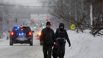
The impact of winter storm Elliott continues in the United States. The powerful system left thousands of people without power, left thousands of flights canceled over Christmas weekend, led to road closures, and has tragically taken thirty-seven lives.
Although conditions improved on Christmas Day Sunday, the storm’s impact and recovery efforts are expected to continue as the storm moves away from the Northeast.
Meanwhile, lake-effect snowfall will continue to create hazardous travel conditions for the next few days, slowly improving over the week. However, according to the National Weather Service, persistent lake-effect snow blowing downwind from the Great Lakes will become less intense. Still, the Arctic air that has engulfed much of the eastern half of the nation will be slow to moderate.
The impact of Winter Storm #Elliott is still being felt in the Northeast!
— The Weather Channel (@weatherchannel) December 26, 2022
After getting slammed with several feet of snow, conditions continue to be dire.
We're LIVE with updates! pic.twitter.com/DlhEk73pyf
How many levels of emergency are there?
Weather alerts are issued by the local offices of the National Weather Service, but the alert system is the same across regions. Some states have their own systems, which are divided into levels of emergency. However, at the federal level, local offices of the NWS can release alerts, warnings, and notices.
What do they mean?
Alerts
- Winter Storm Watches: Issued when conditions are favorable for a significant winter storm event (heavy sleet, heavy snow, ice storm, heavy snow, and blizzard or a combination of events).
- Wind Chill Alerts: Issued when there is a potential for a combination of extremely cold air and high winds to create dangerously low wind chill values.
Warnings
- Blizzard Warnings: Issued for frequent gusts greater than or equal to 35 mph accompanied by snow. This advisory means that severe winter weather conditions are expected or are occurring. Travel is not recommended.
- Winter Storm Warnings: Issued for a major winter weather event that includes snow, ice, sleet, blizzard conditions, or a combination of these hazards. Travel is not recommended.
- Ice Storm Warnings: Issued for ice accumulation of about 1/4 inch or more. Travel is strongly discouraged.
- Wind Chill Advisories: Issued for a combination of very cold air and high winds that will create dangerously low wind chill values. During these events, officials may advise that time outside be limited to just a few minutes to avoid frostbite and hypothermia.
- Lake Effect Snow Advisories: Issued when widespread or localized lake-induced snow showers or heavy showers are expected to produce a significant accumulation of snowfall.
Related stories
Notices
- Winter Weather Advisories: Issued when snow, snow, ice, sleet, or a combination of these winter elements is expected, but conditions are not dangerous to warrant a warning.
- Wind Chill Advisories: Issued when low wind chill temperatures are expected but will not meet the criteria to become an alert.
- Lake Effect Snow Advisories: Issued for widespread or localized lake effect snow accumulations that remain below alert criteria.
Where are warnings currently active?
The NWS currently has hundreds of alerts, warnings, and notices posted. Check out their website for details on any issued for your area. In the top left corner, you can insert your zip code and any releases will be posted.
