Where is the Francis Scott Key Bridge and how long was it?
The Key Bridge in Baltimore, Maryland, collapsed on Tuesday morning after being hit by a large vessel.
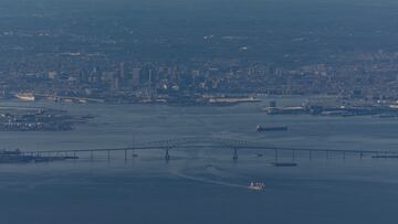

In the early hours of Tuesday 26 March a large vessel – reported to be a 948-foot Singaporean cargo ship – crashed into the Francis Scott Key Bridge in Baltimore causing it to collapse. Several vehicles were seen falling into the water below and rescue efforts were immediately set in motion, with the Maryland Transportation Authority announced its closure, with associated traffic rerouted.

Where is the Francis Scott Key Bridge?
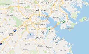
The Key Bridge, part of the Interstare 695, is the outermost of the three toll bridges around Baltimore Harbor. Following the MD 695C ramp, the road elevated onto the Francis Scott Key Bridge, facilitating the passage of I-695 over the lower Baltimore Harbor and Patapsco River. Unlike the Fort McHenry or Baltimore Harbor tunnels, hazardous materials trucks were permitted to traverse the Key Bridge.
Upon crossing the Patapsco River via the bridge, the route descended within the confines of Baltimore city limits, proceeding westward past Thoms Cove and traversing through the industrial zones of Hawkins Point.
How long is Baltimore’s Key Bridge?
Inaugurated in March 1977, the bridge, which extends across the lower Patapsco River and outer Baltimore Harbor, was christened in honor of Francis Scott Key, the esteemed author of the American national anthem. Boasting a principal span measuring 1,200 feet, with a total length of 1.6 miles, it claimed the distinction of being the third longest continuous truss span worldwide and played a pivotal role as a vital connection in Interstate 695, more commonly recognized as the “Baltimore Beltway.”
The four-lane bridge was managed as a toll facility by the Maryland Transportation Authority, facilitating an estimated 11.5 million vehicle crossings annually. Transitioning to modernization, the toll plaza underwent conversion to a cashless system in October 2019.
President Biden has been briefed on the collapse of the Francis Scott Key Bridge in Baltimore and the ongoing search and rescue efforts. He will continue to receive updates from his team throughout the day, the White House says.
— Joey Garrison (@joeygarrison) March 26, 2024
Could you walk or cycle across Baltimore’s Key Bridge?
Related stories
As well as the focus on the vehicles that may have been crossing at the time of the tragedy, there is also a concern that there may have been other commuters on this iconic bridge. There was an option for pedestrians to walk across the Key Bridge and cycling was also a popular mode, with Capital Bikeshare providing a convenient and swift five-minute ride service, placing docking stations at both ends.
The DC Circulator and Metrobus 38B also offered alternative means of transportation to private vehicles. Renowned as one of the area’s oldest surviving bridges, it will be sorely missed.
Complete your personal details to comment