Snow storm on New Year’s Eve and New Year: affected states and trajectory in real time
Here’s all the weather warning information you need to know as we move into 2024.
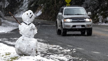

Severe weather continues to spread across the United States. Following a powerful snowstorm that swept across the Great Plains over Christmas, cold temperatures and bad weather are now heading to the Midwest, where another snowfall is forecast to bid farewell to the Old Year.
According to Weather Channel forecasters, about a dozen states in the Northeast and Midwest will see snowfall beginning Friday through New Year’s Eve, which is through the morning of Sunday, Dec. 31. However, the intensities will be lower compared to the Christmas snowfall.
“If you missed a white Christmas, it will snow a little bit in the Midwest, although we’re not expecting a large amount [of snow] from this storm,” explains Weather Channel meteorologist Kait Parker. For its part, the National Weather Service (NWS) noted that “accumulations of around one to two inches are possible, mostly on grassy and elevated surfaces,” so “widespread travel hazards are unlikely.”
With temperatures staying above normal much of the last month, ice on smaller bodies of water has not developed quite as thick as it normally would. Exercise great caution when venturing out on the ice. If you don't know how thick the ice is, don't go! #IceSafety #MIWx #906wx pic.twitter.com/u7YB5OIU7H
— NWS Marquette (@NWSMarquette) December 30, 2023
New Year’s Eve and New Year’s Eve Snowstorm in the USA: Affected States
The Midwest area of the country will be the most affected with the New Year’s Eve snowfall. In states such as Indiana and Missouri the first snowflakes began to fall as early as Thursday, resulting in a light white coating on roads and highways.
For southeastern Iowa, Illinois and Kentucky, the first snowfall will occur beginning Friday night, December 29. The storm will continue to extend into West Virginia, Vermont and parts of northern New York and Maine. The storm is expected to dump five to eight inches of snow in the higher elevations and up to three inches in most of the affected areas. By the start of the New Year, clear weather is expected.
As the storm moves through, northern Alabama and Georgia could also see a light coating of snow.
🧤🥽 #WinterSafety Tip - Dress The Part! You need to be adequately dressed if it is necessary to be outside during periods of cold weather!
— NWS Mobile (@NWSMobile) December 31, 2023
🧥 Dress in layers of loose-fitting lightweight clothing,🧣 Wear a hat & scarf,
♨️ Use blankets to stay warm pic.twitter.com/ijdAVLpjys
Real-time storm tracker
Related stories


Bowl Games on New Year's Day
Below, we share with you an interactive map from Windy.com with the real-time path of the snowstorm, as well as snow accumulation.
For more information and real-time updates, we recommend monitoring the National Weather Service website.