Snow storms on Christmas Eve and Christmas in the US: affected states
The National Weather Service Weather Prediction Center forecasts heavy snowfall in some parts of the US on Christmas. Here are states the storm will hit.
Millions of people will travel over the holidays. Over 115 million people are expected to cover 50 miles or more during the period from December 23 to January 1, according to a projection from the American Automobile Association.
This represents a 2.2% increase over last year and the second-highest year-end travel forecast since 2000. So far, 2019 remains the busiest, with 119 million travelers.
If you plan to travel during this holiday period, we recommend that you be aware of weather changes, as the National Weather Service forecasts heavy snowfall in certain states of the country.
Weather forecast for Christmas Eve and Christmas 2023
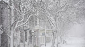
The NWS Weather Prediction Center has reported that heavy snow, near-blizzard conditions and freezing rain will affect holiday travel through Tuesday of next week.
A major winter storm is forecast to develop Sunday night. This will affect the northern/central Plains and upper Midwest with heavy snow, freezing rain and strong winds during the Christmas holiday (Sunday through Tuesday). Widespread effects on travel are likely.
Heavy snow in parts of South Dakota and Nebraska will develop early Monday into Tuesday, with high snowfall rates. This will result in heavy snow accumulations that have a high probability (70- 90%) of exceeding four inches. In places with the heaviest snow, there is a 30 to 50% chance of more than one foot of snow, according to the WPC.
READ ALSO: Fancy some festive fast food?
Sleet and snow
The Weather Prediction Center has also noted that the combination of heavy snowfall and strong winds in the plains could produce near-blizzard conditions, resulting in dangerous travel.
Hazardous conditions include a wintry mix of sleet and freezing rain that will likely blanket parts of the Upper Midwest beginning Monday afternoon.
There is a moderate (50-70%) chance of at least 0.1″ of ice forming in some parts of that area, causing slippery roads and sidewalks.
READ ALSO: Which supermarkets open on Christmas Eve and Day 2022?
A significant winter storm will bring a white Christmas to some, but also hazardous travel to many in the Plains and Upper Midwest. pic.twitter.com/CvexMRLkGc
— NWS Weather Prediction Center (@NWSWPC) December 23, 2023
Weather forecast after Christmas
Related stories


According to The Weather Channel a slow-moving storm system will increase the chances of heavy rain in the Northeast and Upper Midwest of the United States after the Christmas holiday.
At the same time, areas from Northern California to the Pacific Northwest will see increased chances of rain and snow in the mountains due to an approaching Pacific storm, especially on Wednesday.