What is a polar vortex collapse? Meet the phenomenon responsible for the extreme winter weather across US
Parts of the US are braced for more extreme temperatures, affecting central and eastern parts of the country.
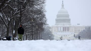
The first days of March brought more severe weather to some parts of the United States. A low pressure front will bring blizzard conditions for portions of the UpperMidwest and Great Lakes through Wednesday night. Meanwhile more thunderstorms will continue to lash Florida to the Mid-Atlantic region with a cold front on the way.
This video is from Papillion, NE tonight where the local NWS blizzard warning in effect until Wednesday morning reads:
— National Weather Service (@NWS) March 5, 2025
“Blizzard conditions expected. Total snow accumulations of 3 to 6 inches expected. Winds gusting as high as 65 mph. Flash freeze expected.”
Get your latest,… pic.twitter.com/xnMJ197zCt
More blizzards and sub-zero temperatures on the way
Today’s forecast predicts a medium threat of tornado, damaging wind gusts and lightning during the night and early hours of Thursday with a low threat of large hail.
And the outlook isn’t great for most of the rest of the country. A huge winter storm is making its way across the central part of the country, bringing with it heavy winds, rain, snow and freezing temperatures.
The devastation was evident in Mississippi where a raging storm left two dead and many properties damaged. Irving, Texas was hit by a tornado with winds up to 110 mph leaving destruction in its path.
4 injured, 3 homes destroyed in suspected Wayne Co. tornado https://t.co/axH3w6lvIk
— WLOX (@WLOX) March 5, 2025
Now the National Weather Service fears another phenomenon could prolong the spell of winter weather for the rest of the month and possibly into April.
Forecasters fear another polar vortex collapse like the one we saw last month could be next. So more arctic weather and “life-threatening” cold temperatures for the next few weeks.
What is a polar vortex collapse?
The National Oceanic and Atmospheric Administration (NOAA) explains that a polar vortex is a large area of low pressure and cold air currents which circulate around both of the Earth’s poles. It has a circular shape and is at it’s peak during the winter months.
A polar vortex occurs when the layer between 10 and 50 kilometers above the Earth’s surface heats up to 50 degrees over a short space of time - usually during a period of less than two days (sudden stratospheric warming - SSW).
Numerical models now predict a split in the polar vortex by the 11th or 12th of March - with widespread implications for weather across the Northern Hemisphere for the last parts of Winter and early Spring. #Weatherscape - Tell Better Weather Stories pic.twitter.com/3xGw827YCM
— MetraWeather (@MetraWeatherUK) February 28, 2025
The event pushes freezing Arctic air south, causing major snowstorms and sending temperatures plummeting.
The big worry is if there is a split in the jet stream pattern. AccuWeather’s Lead Meteorologist Paul Pastelok explained the situation to The Independent: “We are predicting a displacement of the polar vortex on the Europe and eastern Canada side of the polar. When the Polar Vortex is disrupted - whether stretched, displaced, or split - it can, but does not always, impact this polar jet stream. The timing is uncertain for North America but could see a change in the pattern for late March into early April”.
Related stories
Get your game on! Whether you’re into NFL touchdowns, NBA buzzer-beaters, world-class soccer goals, or MLB home runs, our app has it all.
Dive into live coverage, expert insights, breaking news, exclusive videos, and more – plus, stay updated on the latest in current affairs and entertainment. Download now for all-access coverage, right at your fingertips – anytime, anywhere.
Complete your personal details to comment